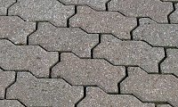
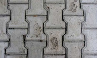
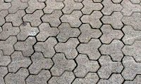
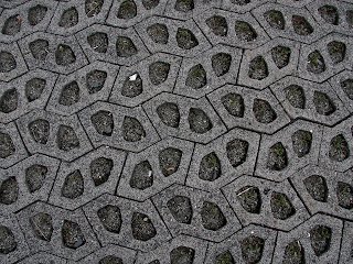
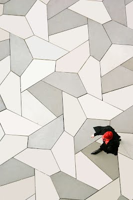
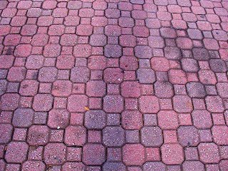
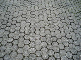
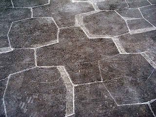
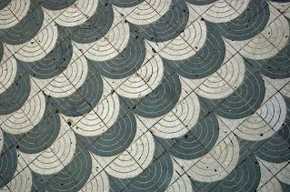
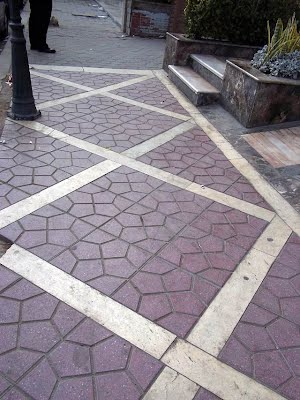
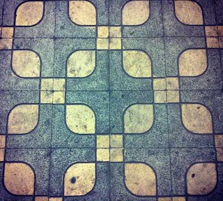
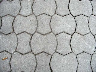
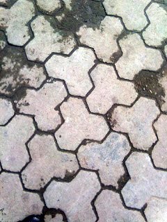
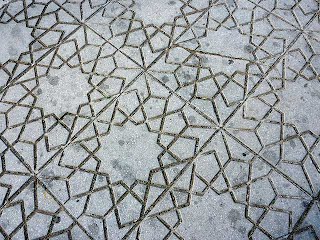
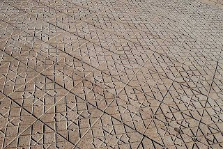
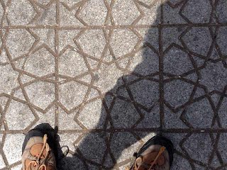
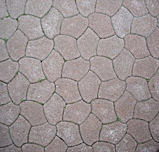
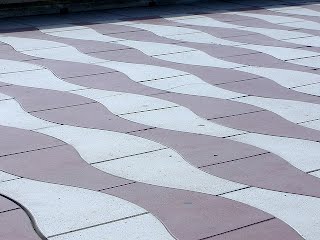
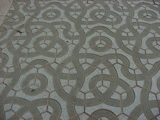
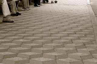
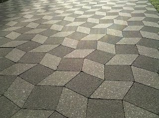
The first of three pages (so far) on tessellations as actual pavements, and related aspects, of which the first has as its premise images from around the world, with a short introduction, the second, patents, and third, a miscellany, covering more topics but rather of a less extensive extent, that quite simply do not justify distinct pages. Street Pavements One of the relatively few applications tessellation has is in the use of actual street pavings. Pavings as such have a long history, seen worldwide. Indeed, street paving has been found from the first human settlements around 4000 BC in cities of the Indus Valley Civilization on the Indian subcontinent in modern day Pakistan, such as Harappa and Mohenjo-Daro. Roads in the towns were straight and long, intersecting one another at right angles. However, quite when the first side pavings, or sidewalks were instigated is under investigation. Of interest mathematically is to what tessellations have been chosen for this purpose, in that what is it exactly that makes a certain tiling attractive enough to be manufactured as a paving? Or is there no real understanding of the issue, with any tiling too hand largely arbitrarily selected? There are seemingly instances of both aspects to be seen. Undoubtedly, there is mostly a utilitarianism concern here, with aesthetics largely secondary. Mostly, pavings are ‘plain’, as squares or rectangles, likely for the sake of convenience of the worker placement, and indeed cost; after all what can be easier than to lay paving slabs with such obvious shapes. A little more imagination is shown with regular hexagons, but these too are of an everyday nature. As such, it can be said that the instigator, or installing body of such instances lacks imagination, and so aesthetically in this context such instances are largely excluded from this particular page. However, when for some reason there is indeed an aspect of interest, I do occasionally make an exception to this rule. However, rectangles can indeed be made to tile in a variety of interesting ways, and so these I show on the ‘Miscellaneous’ page. Although these can be described as slightly more ‘interesting’ than those described above, to me at least it still does not display enough imagination to qualify as ‘of interest’ here, and so again such instances are thus excluded on those grounds. As such, pavement designs are to all intents and purposes largely anonymous as to a named designer, with any one design, where indeed accompanied by a description, is simply described as according to a trade name or catalogue number. However, on occasions, some do indeed acquire more attention than others, and not necessarily due to sheer frequency as might otherwise be thought. Simply stated, there are two pavements with named associations, not after a named designer, but rather of cities. Undoubtedly, the more well known instance, at least to mathematicians (if not the general public), is the ‘Cairo tiling’, or has at least acquired this name, in Egypt, and the decidedly lesser known ‘Baldaso de Bilbao’ in Spain. Indeed, although the Cairo tiling is indeed notable in terms of frequency of sightings (although now sadly diminishing, with constant renovations; it not being replaced and not currently being manufactured), it has really only come to prominence by chance matters. I document the full story on my Cairo pages, but in brief, it was instigated in 1957 by Ramzi Omar, but not named as such at the time, and only much later was it so named from a single sighting, by James Dunn in a 1971 mathematics article who stated it was a ‘favourite’ (due to the sheer extent of a sighting, at Cairo airport, but not frequency, although likely it was indeed by then). Martin Gardner in a mathematics 1975 article picked up on this, in a sense misreporting from Dunn’s article, stating it was ‘frequently seen’, from which it then gained worldwide fame. As the paving is more fully discussed elsewhere, I thus defer to those writings. Furthermore, there is also another paving that has been given a name after its city of origin, namely the ‘Baldaso de Bilbao’ (Tile of Bilbao), although this lacks any tessellation element, and is rather of a geometric design of a circular composition, yet nonetheless, it is interesting on account of its popularity. Pleasingly, it has a documented history, as well as a named designer although both a little hazy as to specifics; different dates and designers are quoted, all of which I discuss on the miscellaneous page in more detail. This page is thus dedicated to showing those pavings that are thus a little ‘out of the ordinary’, having some degree of aesthetic interest, thereby showing more imagination from the instigator than otherwise with the more commonly seen squares and rectangles. Furthermore, of interest in that likely a non-mathematician has selected a certain tiling to manufacture, and so it is interesting in observing what a likely outsider to mathematics considers to be attractive. Below I show the world’s offerings, or at least what I can find, of what I term as ‘interesting’. However, by its very nature, this is a daunting task! It may very well be some have been excluded. Even after many years of searching, it is not uncommon for me to find numerous instances from any one country. Romania was a case in point. Nothing at all for many years, and then someone with an appreciation for such designs posts a page replete of examples. Also included are some pavings that are not strictly tessellations, but of optical illusions, and so as by default are ‘of interest’. And likewise where, showing some degree of imagination, despite being of rectangles, squares, or hexagons I nonetheless make an exception to my rule for these polygons. Also, on occasions, I show some consisting of interesting geometrical designs. The countries shown are: Argentina, Australia, Azerbaijan, Brazil, Bulgaria, Canada, Canary Islands, China, Egypt, Ecuador, Germany, India, Japan, Morocco, Netherlands, Nigeria, Norway, Poland, Portugal, Romania, South Korea, Spain, Syria, Thailand, Ukraine, United Arabic Emirates, US and UK. Likely there are many more countries, but they have simply not been documented by travellers. Curiously, some countries seem to favour certain types. Spain seems to have a loose ‘tradition’ of illusion types, with three instances. Morocco, not unsurprisingly, favours those based on traditional Islamic patterns. This would thus not seem to appear by chance; does anyone know of the circumstances behind this? The distribution of interesting placements is seemingly at whim; some countries seem to have a rich variety, whilst others are totally lacking! Of the pavings shown, it can be seen that some instances are more popular than others, despite these being separated by continents, and so likely of some connection, although I do not see how. Is there an ‘international association of paving manufacturers’ to explain this? Of note is what I descriptively term as the ‘Wavy Rectangle’, ‘Dumbbell’, and ‘fused hexagons’ below. All of these feature extensively. Armenia Argentina
 © 'dmsperkins', Buenos Aires  Australia
 © Ross F. Housholder, Melbourne Austria   © Maria Cristina Travaglio, Vienna 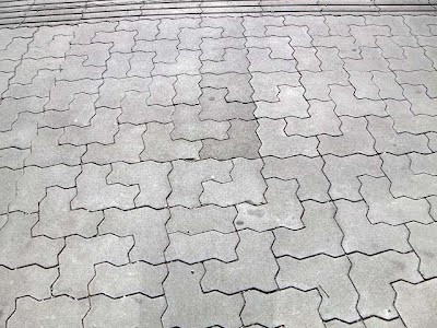 © Ross F. Housholder, Innsbruck railway station Innsbruck, population 132,493 (2018), is the capital city of Tyrol in western Austria and the fifth-largest city in Austria. Innsbruck is an internationally renowned winter sports center, and hosted the 1964 and 1976 Winter Olympics as well as the 1984 and 1988 Winter Paralympics. Azerbaijan 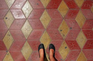 © Olga Schlyter Baku http://www.flickr.com/photos/olgasch/5030086459/   © Huseyneli Huseyneliev Although most geometrical pavings are ‘abstract’, occasionally an Escher-like tiling is used, as in this example of a ram from Azerbaijan, by Mammad Huseynaliyev a physicist from Azerbaijan National Science Academy. The ram was chosen, not by chance, but for a specific reason, in that it is highly symbolic for the city of Nakhchivan, the capital of the eponymous Nakhchivan Autonomous Republic of Azerbaijan, located 450 km west of Baku. Many sculptures from medieval times featuring a ram can be seen across the region, hence the choice here. The curved figure with the ram paving inside is called a ‘Buta’ and is a typical detail of Azerbaijani national ornament and is considered the symbol of Azerbaijan. Brazil  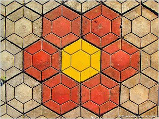 © Ju Row Farr San Paulo Note that the tiles are a stylised picture of the state of San Paulo © Carlos Strauch Santo Antonio de Jesus Bulgaria 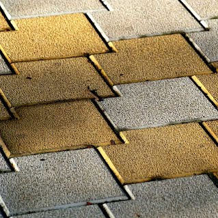 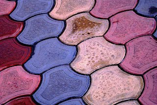 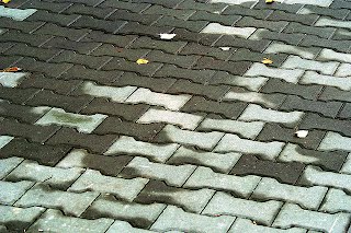 © 'Miuenski' Canada
  © Tom Magliery Downtown Vancouver, West End. Observe the curious clustering, of four circles combined. Bentall Tower Two Caribbean Countries 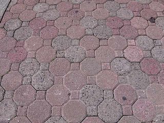 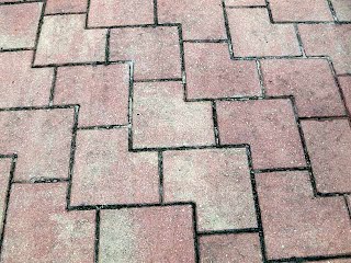 © Ross F. Housholder Puerto Rico, St Maarten Canary Islands
 © David Barrington Playa del Ingle, Gran Canaria China
  © Melisande Also see an instance in Norway. © Lance Belville, Beijing, close to the temple of heaven  Cuba © J. Eric Lynxwiler. Havana, Cuba in May 2015.
The terrazzo is in front of the 1912 train station but that station was modernized in the 1950s or so. The terrazzo likely dates to that renovation. Denmark
 © Olga Schlyter, Copenhagen
Ecuador
 © Gary A. Scott Egypt
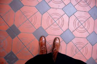
Egypt has a multiplicity of geometric street pavings, of which one of these, consisting of pentagons, has become so well-know as to have the attribute ‘Cairo tiling’ as detailed in the introduction.  The Cairo Tiling © Helen Donnelly  © Helen Donnelly, Dokki, Cairo © Helen Donnelly, Dokki, Cairo
 © Pam Garnett, Cairo
 © Alia Nassar, Port Saad France
 © Carole Hurel, Sisteron Germany
 © Ross F. Housholder, Garmisch-Partenkirchen Garmisch-Partenkirchen, population 27,194, is a ski town in Bavaria, southern Germany. It is the seat of government of the district of Garmisch-Partenkirchen (abbreviated GAP), in the Oberbayern region, which borders Austria. Nearby is Germany's highest mountain, Zugspitze, at 2,962 m (9,718 ft.). The town is known as the site of the 1936 Winter Olympic Games. 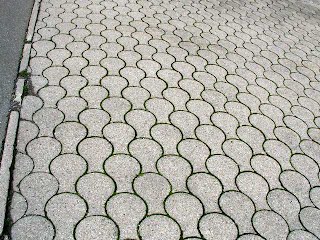 © Ross F. Housholder, Hammersbach Hammersbach, population 4,818, is a municipality in the district of Main-Kinzig-Kreis, in Hesse, Germany, near Frankfurt am Main. 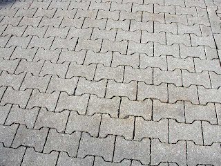 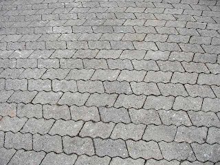 © Ross F. Housholder 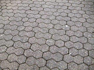 © Ross F. Housholder, Bingen am Rhein 1 Bingen am Rhein, population 25,659 (2018), is a town in the Mainz-Bingen district in Rhineland-Palatinate, Germany. 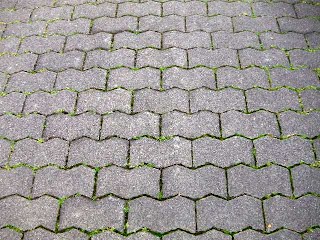 © Ross F. Housholder, Bingen am Rhein 2 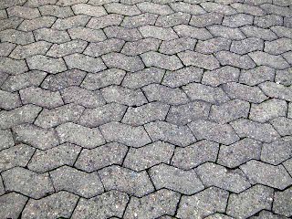 © Ross F. Housholder, Bingen am Rhein 3 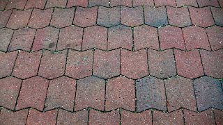 © Ross F. Housholder, Landshut © Ross F. Housholder, LandshutLandshut (Austro-Bavarian: Landshuad), population 70,000, is a town in Bavaria in the south-east of Germany. Situated on the banks of the River Isar, Landshut is the capital of Lower Bavaria, one of the seven administrative regions of the Free State of Bavaria. Landshut is the largest city in Lower Bavaria. 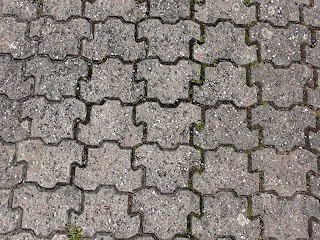 Karlsruhe (formerly spelled Carlsruhe) population 309,999 (2016) is the second-largest city of the German federal state of Baden-Württemberg after its capital of Stuttgart, and is the 21st largest city of Germany. On the right bank of the Rhine, the city lies near the French-German border. 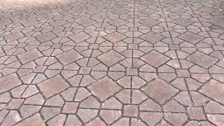 © Ross F. Housholder, Farchant Farchant, population 3,660, is a municipality in the district of Garmisch-Partenkirchen, in Bavaria, Germany (on the southern border). 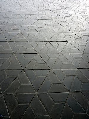 © Anders Sandberg, Berlin Airport Berlin, population 3,748,148 (2018), is the capital and largest city of Germany by both area and population. Its inhabitants make it the second most populous city proper of the European Union after London. The city is one of Germany's 16 federal states.
Wasserkuppe is a mountain within the German state of Hesse. It is a large plateau formation at an elevation of 950 metres (3,120 ft) and is the highest peak in the Rhön Mountains. 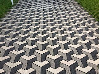 © Henry Segerman, Heidelberg, on Berliner Strasse, north of the university Heidelberg, population 159,914 (2016) is a university town in the German state of Baden-Württemberg, situated on the river Neckar in south-west Germany. Heidelberg is part of the densely populated Rhine-Neckar Metropolitan Region.
Greece 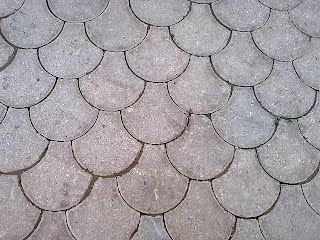 © Liane McCarthy, Polichronos Hungary 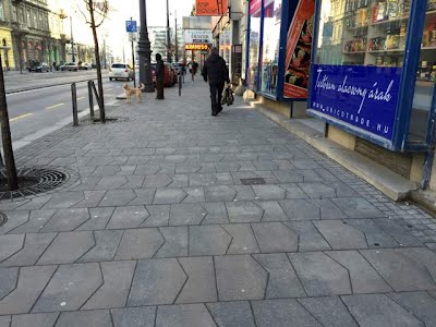 Iceland  © Ross F. Housholder, Akureyri India
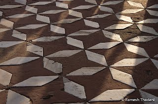
© Ramesh Thadani, Agra, Taj Mahal
The first of three pavings outside the Taj Mahal, Agra, which has some interesting pavings. This consists of two tiles. Different interpretation of this tiling are possible which this feature could explain its popularity: (i) This could be described as of ‘interlocked octagons’. (ii) Of two tiles, of star octagons and rhombs, or alternatively of either star octagons or rhombs as entities in their own right, with negative spaces.
  © Tom Magliery, Agra, Taj Mahal
© Yazed Lord, Mumbai Japan
© Yoshiaki Araki, In front of the Musashi-Koganei station of Japan Railway Chuo line, Tokyo. An instance of the 'Cairo tiling' in Japan!
 © Jun Nishiseko, Hamamatsu, Shizuoka Prefecture. Another instance of the 'Cairo tiling' in Japan! 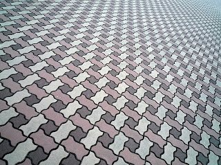 © Rob, Ritsumeikan University, Kusatsu  © 'Furdis', Tokyo
Kenya  © Isabelle Prondzynski, Mbotela, Nairobi
Kyrgyzstan Pictures from Ian Claytor, an English expat (and ex maths teacher) and now resident in Kyrgyzstan. The pictures are what he had seen and found interesting around the capital and largest city, Bishkek. A brief background. Bishkek, formerly Pishpek and Frunze (Kyrgyz Republic) has a long-standing Soviet-era influence, with Russian the main language. Bishkek is the most populated city in Kyrgyzstan; its population, estimated in 2019, was 1,012,500.   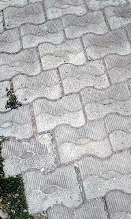 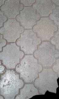 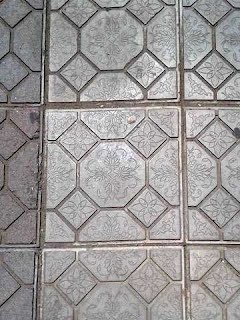 Mongolia
 © Katharine M, Ulaan Baatar Morocco
Morocco is interesting in that it is one of the few Islamic countries (indeed the only on e so far) that uses traditional Islamic-type designs for its pavements.
 © Richard Chester, Marrakech
  © 'Kitticot', Marrakech
© Robert Ferreol, Marrakech Detail
© Christopher Rose Netherlands
© Roi Shiratski, Funepark, outskirts of Amsterdam. As designed by Martien Osch. An interesting design, of two pentagons 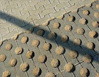 © 'Avril' Nigeria
 © Jennifer Ehidiamen, Lagos Norway
© Tom Magliery, Oslo Oman
© 'Shimmertje', Muscat
Poland
 Zakopane Pleasingly, I now have more detail as to the ‘Zakopane Heesch paving’ sighting, due to the sterling efforts of Tom Jacobs, who has been investigating this recently (September 2016), and who, like myself, sought further detail. Previously, first shown on Wikipedia [1] in 2005, all that was known was of a Zakopane reference, of a single, close-up picture of the paving, of a brief, one-line comment, with scarce detail: 1. Why is it in Zakopane, a smallish town with no known mathematical background? 2. Why is it outside the market place? 3. Why only tiling No. 9 (in particular) of the set of 28? 4. Is it confined to the two places as detailed? 5. Who instigated the project and to what reason? 6. When was it installed? Can anyone add anything to this? No detail is too small to mention. References [1] https://commons.wikimedia.org/wiki/File:Wallpaper_group-p3-1.jpg Portugal
 © Claire McCann, Almeria. An optical illusion, or effect, of which Portugal and Brazil are famous for Romania Romania, or in particular Bucharest, has an abundance of interesting tessellating pavements. Bucharest, population 2,106,144 (2016), is the capital and largest city of Romania, as well as its cultural, industrial, and financial centre. It is located in the southeast of the country, on the banks of the Dâmbovița River, less than 37 miles) north of the Danube River and the Bulgarian border. Bucharest was first mentioned in documents in 1459. It became the capital of Romania in 1862 and is the centre of Romanian media, culture, and art. Its architecture is a mix of historical (neo-classical and Art Nouveau), interbellum (Bauhaus and art deco), communist era and modern. 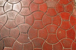 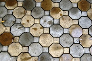 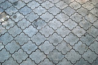 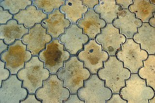 © Matthew Reames Note a different arrangement of the tiles, top left Yet another instance of the favoured ‘dumbell’ tile, seen worldwide. Note that the ‘dumbell’ has variations, and can be shortened or lengthened and yet still tile, as in the next photo. Another of the popular instance, which also has a variation as to placement; see following picture This can be interpreted as a variation of the well-known Cairo tiling, with circle arcs replacing the four ‘variable’ straight line sides. The simplest interpretation of this can be described as that of the ‘axe head’ tessellation, with a dividing line. Note that other, circle arc variations can be determined; New Mathematical Pastimes, by P.A. MacMahon, p. 105, gives some others. Probably the most favoured instance of the eight semi-regular tilings, of 4. 8. 8. Spain
© Keith Sharps
© Ross F. Housholder, Alicante Alicante, population 330,525 (estimated 2016), is a city and port in Spain on the Costa Blanca, the capital of the province of Alicante and of the comarca of Alacantí, in the south of the Valencian Community. It is also a historic Mediterranean port.
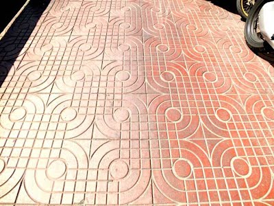
 © Ross F. Housholder, Puerto de la Cruz, Tenerife Interlacing bands Puerto de la Cruz, population 30,483 (2018), is a city and municipality in the northern part of the island of Tenerife, Canary Islands, Spain. It was formerly known by its English translation, "Port of the Cross", although now it is known in all languages by its Spanish name. It is located on the north coast, 2 miles northwest of La Orotava, and 19 miles west of Santa Cruz de Tenerife. In Spanish the inhabitants are known as Portuenses. With an area of (3 square miles, the municipality is the smallest in Tenerife. 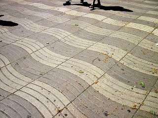 Wikipedia Commons Barcelona, Rambla An optical illusion; believe it or not, the tiles are rectangular!
© 'Mooste' Malaga
© 'Brit and Armand', Malaga. Although not strictly a tessellating pattern; interesting geometrically nonetheless Málaga, population 571,026 (2018), is a municipality, capital of the Province of Málaga, in the Autonomous Community of Andalusia, Spain. It is the second-most populous city of Andalusia and the sixth-largest in Spain. The southernmost large city in Europe, it lies on the Costa del Sol (Coast of the Sun) of the Mediterranean, about 62 miles east of the Strait of Gibraltar and about 81 miles north of Africa. Málaga's history spans about 2,800 years, making it one of the oldest cities in Europe and one of the oldest continuously inhabited cities in the world.
Bilbao
As broadly outlined in the introduction, Bilbao has become well known for a design on pavements, with ‘Baldosa de Bilbao’ (Tile of Bilbao), and cannot possibly be overlooked, of which it is used to pave the streets literally all over the town. Indeed, estimates are that 600,000 tiles are replaced each year, of a total through the years of 66 million. Motif Used The design consists of a rosette motif with or without carved channels, the latter mostly serving a utilitarian purpose. The design was aimed at making pedestrians a little safer in Bilbao’s rainy climate (which is captured in almost all the photos), by allowing the water to drain into the carved channels and away from the surface of the tile, thus making it less slippery. Curiously, there are many other tile designs similar to the rosette style, and in different sizes, with some even pre-dating the Bilbao tile. Ubiquity The design is linked so strongly to Bilbao’s identity that museum and souvenir shops are stocked with ceramic mugs, posters, soaps, t-shirts, shoes, ties, towels, key chains, pastries and chocolates all featuring the rosette tile design. They even have a Facebook page (in Spanish) dedicated to them! Date of Introduction and Designer Both the date of introduction and the designer of the tiles is a little uncertain. Some reports date their first production to the 1920s and 1930s, attributed to Eduardo Saenz Venturi, brother of the sculptor Federico Saenz Venturi from Bilbao, while others say they came about in the 1940s and 1950s in a municipal workshop. Format
Initially, the tiles were made using concrete and coarse sand, with a covering of iron shavings in a 15 x 15 cm format, though this kind of material didn’t adhere well to the ground and left many pedestrians who stepped on loose tiles soaked in rain water. Nowadays, almost all of the old tiles have been removed and replaced with new ones that are manufactured with cement at a standard size of 30 x 30 cm, although other, both smaller and larger formats can be seen occasionally, such as a ‘giant’ 60 x 60 cm tile. Overseas Initially endemic to Bilbao, the tile design was eventually exported to many cities throughout Spain and Argentina and other South American countries, and Africa (in the former colony of Equatorial Guinea). All pictures with permission, from: http://groundbeneathmyfeet.wordpress.com/tag/pavement/ 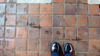 © Ekaterina Petrova, Bilboa, 1-3 Bilbao, population 345,141 (2015), is a city in northern Spain, the largest city in the province of Biscay and in the Basque Country as a whole. It is also the largest city proper in northern Spain. Bilbao is the tenth largest city in Spain. The Bilbao metropolitan area has 1,037,847 inhabitants, making it one of the most populous metropolitan areas in northern Spain; with a population of 875,552 the comarca of Greater Bilbao is the fifth-largest urban area in Spain. Bilbao is also the main urban area in what is defined as the Greater Basque region.    © Ekaterina Petrova, Barcelona Barcelona, population 4.8 million (2018), is a city in Spain. It is the capital and largest city of the autonomous community of Catalonia, as well as the second most populous municipality of Spain. With a population of 1.6 million within city limits, its urban area extends to numerous neighbouring municipalities within the Province of Barcelona and is the sixth most populous urban area in the European Union after Paris, London, Madrid, the Ruhr area and Milan. It is one of the largest metropolises on the Mediterranean Sea, located on the coast between the mouths of the rivers Llobregat and Besòs, and bounded to the west by the Serra de Collserola mountain range, the tallest peak of which is 512 metres (1,680 feet) high.
Switzerland   © Maria Cristina Travaglio 1-4 Lausanne Lausanne, population 139,056 (2018) is the capital city and biggest town of the canton of Vaud in Romandy, Switzerland. A municipality, it is situated on the shores of Lake Geneva It faces the French town of Évian-les-Bains, with the Jura Mountains to its north-west. Lausanne is located 38.5 miles northeast of Geneva.    © Maria Cristina Travaglio Ollon Ollon, population 7,461 (2018), is a municipality in the district of Aigle in the canton of Vaud in Switzerland, sited in the foothills of the mountains to the south-east of the Lake of Geneva. The old German language name Olun is no longer used. Tajikistan Dushanbe (the capital), Tajikistan. The first ‘arrow’ paving seen. Background matters as to this sighting, as the extent and frequency and went unresolved.  © Alisdair Lennox Dushanbe, population of 802,700 (2016), meaning Monday, in Taji is the capital and largest city of Tajikistan. It was named this way because it grew from a village that originally had a popular market on Mondays. Historically a small village, Dushanbe was made the capital of the Tajik Autonomous Soviet Socialist Republic in 1924. Thailand
  © Miroslaw Majewski, Bangkok  © Miroslaw Majewski, Bangkok Temple Bangkok, population 8 million, is the capital and most populous city of Thailand. It is known in Thai as Krung Thep Maha Nakhon or simply Krung Thep. The city occupies (605.7 square miles in the Chao Phraya River delta in central Thailand, or 12.6 percent of the country's population.
Turkey  © Molinita
 © J. Brew Ankara Ankara, population 4,587,558 in the urban center (2014) and 5,150,072 in its province (2015), is the capital of Turkey. It is Turkey's second largest city after Istanbul (the former imperial capital), having outranked İzmir in the 20th century.
United Arab Emirates  © Joshua Vorbis, Abu Dhabi Abu Dhabi, population 1.45 million (2016) is the capital and the second most populous city of the United Arab Emirates (the most populous being Dubai). It is the largest of the UAE's seven emirates and also the capital of the Emirate of Abu Dhabi. Abu Dhabi city is situated on an island in the Persian Gulf off the central western coast, while the majority of the city and Emirate reside on the mainland connected to the rest of the country.
United Kingdom An interesting sighting, in many ways, is of pavements of the city of York, United Kingdom. This consists of two conjoined regular hexagon, subdivided into further hexagons. Although in itself this is arguably not aesthetically the most exciting pavement design, what is interesting here is the age, described as of from the 19th century, as well as the extent, found throughout York’s back alleys. Further, and more accurately, these can be found widespread in the North East region of England, and in particular, Durham and Darlington. Indeed, unlike other cities and towns, York can in a sense be said to have ‘adopted’ this paving, as a York icon (similar to Baldosa de Bilbao (Tiling of Bilbao), although not to such an extent), not just in usage, with it appearing in many old back alleys, but also of a more modern-day appearance. Recently, as of 2015, ceramic tiles have been added to the exterior of the York Art Gallery, Centre of Ceramic Art, to acknowledge York’s paving past. Their history is most interesting, of which although much is known, the full story remains to be told. These were made (along with more orthodox rectangle pavers) by Joseph Woodard, of York, who formed the Tees Scoria Brick company in 1873 (wound up in 1972), and who took out a US patent, 191,504, for making what is known as scoria bricks, from the waste of the iron industry. However, these gradually fell out of favour, as according to modernisation with the introduction of the car, but are still surviving in back alleys and courtyards to the present day. When these went out of production is not known, but likely well before the demise of the company. Of note is the bluish sheen, formed as part of the manufacturing procedure. However, sad to say, these are still conflicting with the demands of the modern age as regards pavement usage, being replaced by ugly asphalt! One curiosity is that these are sometimes called ‘Rosemary Setts’, first referenced in a York council document, ‘Back Lane Resurfacing Policy’, of 3 August 2004, although it is a mystery why these are so-called. Does any reader know? Pleasingly, I am not the only one concerned as to their fate; Lisa @YorkStories, a citizen of York (and from whom much of the above story is taken), has written extensively on these, and on pavements per se in York in general, with of particular note as to the above: http://yorkstories.co.uk/paving-part-2-down-the-alleys/ http://yorkstories.co.uk/art-gallery-stable-paviour-tiles/ Can anyone add to the story here (and in particular their naming)? I am aware of other writings by Bob Mullen, Chris Lloyd and Keith Robertson. I might just add that this notable and extensive York sighting has only recently come to my attention (July 2017), surprisingly so, given that I began investigating paving matters extensively in c. 2012, and so who knows, after all this time, what may still be out there. 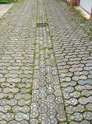 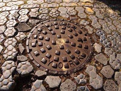 © Lisa @YorkStories York, population 208,200 (2017) is a city and unitary authority area in North Yorkshire, England, Located at the confluence of the Rivers Ouse and Foss, it is the county town of the historic county of Yorkshire. The city is known for its famous historical landmarks such as York Minster and the city walls, as well as a variety of cultural and sporting activities, which makes it a popular tourist destination in England. It is about 20 miles north-east of Leeds.  © Keith Sharps, Newbiggin-By-The-Sea, Northumberland Northumberland is a unitary authority and a Historic County in North East England. The northernmost county of England, the unitary authority borders Cumbria to the west, County Durham and Tyne and Wear to the south and the Scottish Borders to the north. To the east is the North Sea coastline with a path 64 miles long. The county town is Alnwick, although the county council is based in Morpeth. 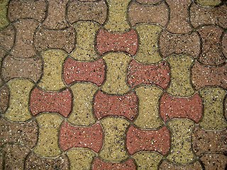 © Donna Smillie London, Southall Railway Station 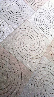 © Donna Smillie London, Southall Railway Station London, population 8,908,081 (2018), is the capital and largest city of England and the United Kingdom. Standing on the River Thames in the south-east of England, at the head of its 50-mile estuary leading to the North Sea, London has been a major settlement for two millennia. Londinium was founded by the Romans. The City of London, London's ancient core − an area of just 1.12 square miles and colloquially known as the Square Mile − retains boundaries that follow closely its medieval limits. 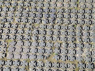 © 'IQ89', Green Park, London © Roger Marks Birmingham United States of America © Benjamin Esham, New York © Virginia Knowles, Lake Lily  © Joe Schumacher, Pittsburg
Although I wasn't going to include the commonly to be seen hexagon, I here make an exception. Of note is the sheer size of the hexagons - contrast with the doorway!
 © Cathy Myers, Newburgh, New York 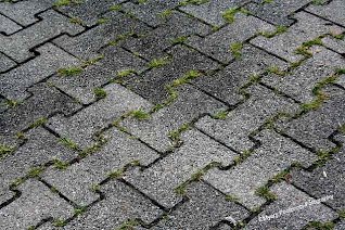 © Susan Sermoneta, New York City
 © 'b.ca5ual', Washington DC near L'Enfant Plaza Washington, D.C.,population 702,445 (2018), formally the District of Columbia and commonly referred to as Washington, D.C., or the district, is the capital of the United States. Founded after the American Revolution as the seat of government of the newly independent country, Washington was named after George Washington, the first president of the United States and a Founding Father. As the seat of the United States federal government and several international organizations, Washington is an important world political capital. The city, located on the Potomac River bordering Maryland and Virginia, is one of the most visited cities in the world, with more than 20 million tourists annually. 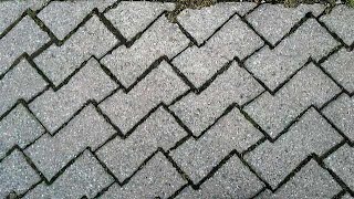 © Shelly S. Roosevelt Island, New York http://www.flickr.com/photos/shellysblogger/ The City of New York, usually called either New York City (NYC) or simply New York (NY), population of 8,398,748 (2010) distributed over a land area of about 302.6 square miles, is the most populous city in the United States. New York is also the most densely populated major city in the United States.
© Roger Marks Birmingham
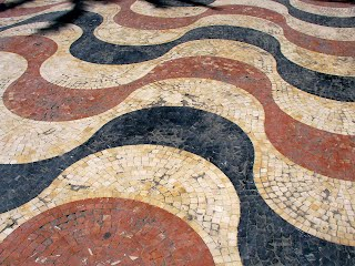
Zambia 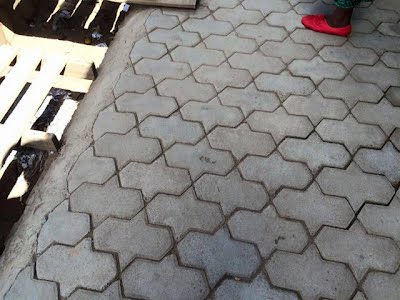 Ndola, population 475,194 (2010) is the third largest city in Zambia after the capital, Lusaka, and Kitweand. It is the industrial and commercial center of the Copperbelt, Zambia's copper-mining region, and capital of Copperbelt Province. It lies just 6 miles from the border with DR Congo. Unknown Location 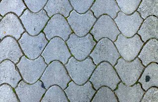 Pavements – Optical Illusions On occasions, pavements are designed with optical illusions in mind, and in particular, some countries almost make this a feature, namely with Portugal and Brazil, with wavy designs.
Created: 2 March 2012. Updated: 14 September, 13, 21 November, 12, 17 December 2012; 9 March 2013. 11 January 2016. Zambia added. 15 January 2016. Austria and Switzerland added. 24 February 2016. Budapest. 1 August 2016. Heidelberg, Germany, picture from Henry Segerman. 19 January 2017. Azerbaijan, picture from Huseyneli Huseyneliev. 1 August 2017. York, United Kingdom, text and pictures added. 8 August 2017. Tajikistan, Dushanbe. 5 June 2018. Germany, pictures from Frank Housholder, of Karlsruhe. Guy Sachar links added of Armenia and Kyrgyzstan. 26 June 2019. Kyrgyzstan. Pictures from Ian Claytor added. 24 October 2019. Fanchant, Germany, Pictures from Frank Housholder added. Also added, for the sake of general interest, brief background details of the cities and towns, taken from Wikipedia, as well as a broad, initial guide to the mathematical tourist. Not all entries essentially required such detail, such as London and New York, but for the sake of consistency I have included. Re-organised, revised 25 April 2019. Last updated 24 Ocrober 2019. |